A Plan of the Battle, on Bunkers Hill Fought on the 17th of June 1775
A detailed historical map that illustrates the strategic positions and movements of American and British forces during the 1775 Battle of Bunker Hill
Historical Period
The American Revolution and A New Nationincludes
12 Analysis questionscontributing partner
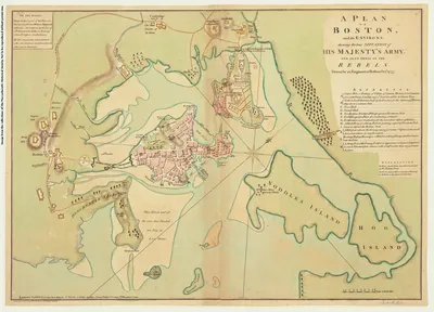
“A Plan of the Battle, on Bunkers Hill Fought on the 17th of June 1775” is a historical map created by Robert Sayer and John Bennet. Issued only a few months after the Battle of Bunker Hill, it shows the positions and movements of the American and British forces on and around Breed’s Hill. The map includes detailed annotations, ship identifications, and elevation markings. A note in the Charles River just west of Charlestown Neck reads, “hither the Ships ought to have come” – reflecting General Henry Clinton’s recommendation to trap the Americans on the Charlestown peninsula, which was overruled by General William Howe. The map features a letter from the British General Burgoyne to his nephew Lord Stanley written just a few days after the battle, providing insights into the battle’s strategies and significance during the American Revolutionary War.
Creator:
Robert Sayer and John Bennett
Date Created:
1775
Materials and Measurements:
1 map : hand colored; 35 x 35 cm. matted 63 x 49 cm.
Point of Origin:
London
Object Identifier #:
MAP L2013F35f
Citation Label:
The Society of the Cincinnati, The Robert Charles Lawrence Fergusson Collection.
Export Slides & Handouts
This primary source is ready-to-go as a presentation for classroom facilitation with questions via Google.
A Plan of the Battle, on Bunkers Hill Fought on the 17th of June 1775
Viewing:
Analysis Questions
Foster inquiry and understanding with these source-specific questions, designed to be accessible even for those with limited background knowledge.
say hello to the source
-
1.
What does this map depict?
-
2.
What do you see or observe about the terrain depicted on the map? What makes you say that?
-
3.
What do you wonder about the battle after looking at this map? What questions do you have?
-
4.
Are there any unusual features on this map that stand out to you or that you’re curious about?
make observations
-
5.
Are there any special markings or symbols on the map? What information do these give you?
-
6.
Look closely at the section of the map labeled Bunkers Hill and Charlestown. What information does this section of the map provide?
interpret what you see
-
7.
What was happening in the Thirteen Colonies when this map was created?
-
8.
The map was created shortly after the Battle in 1775, as indicated by the date in its title. It was published in London by Robert Sayer and John Bennet. The letter at the bottom is from the British General Burgoyne. What does this information tell you about the likely perspective of the person who created the map?
-
9.
What do you think this map might have helped someone in 1775 do or understand?
-
10.
Why do you think someone created and published this map, so soon after the battle was fought?
use it as evidence
-
11.
Though the British won the Battle of Bunker Hill, they suffered nearly twice as many casualties as the American colonists. How might this have influenced the creation or publication of the map? What else would you need to know to better understand its purpose?
-
12.
How do you think historians might use a map like this? Why is it considered a valuable tool?
Related Educational Videos(1)

Found in This Collection, 1 items
There’s even more for Beta Users
Get Access to Everything
More Primary Sources In:
The American Revolution and A New Nation

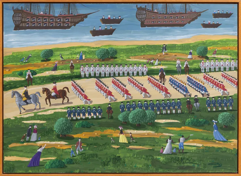
Landing of General Lafayette
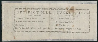
Prospect Hill. Bunker's Hill.

British Surrender at Yorktown, 1781

Teapot
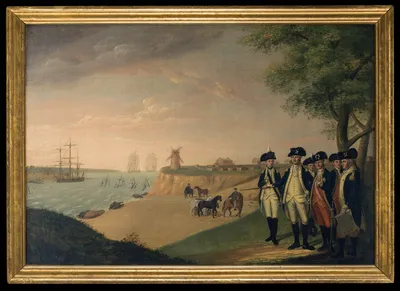
Washington and His Generals at Yorktown

Bushnell Submarine Turtle
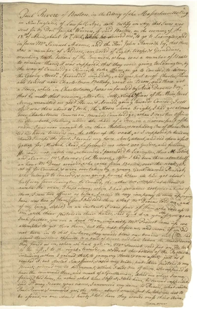
Paul Revere Deposition of the Midnight Ride, 1775
A Plan of Boston, and its Environs Shewing the True Situation of His Majesty's Army