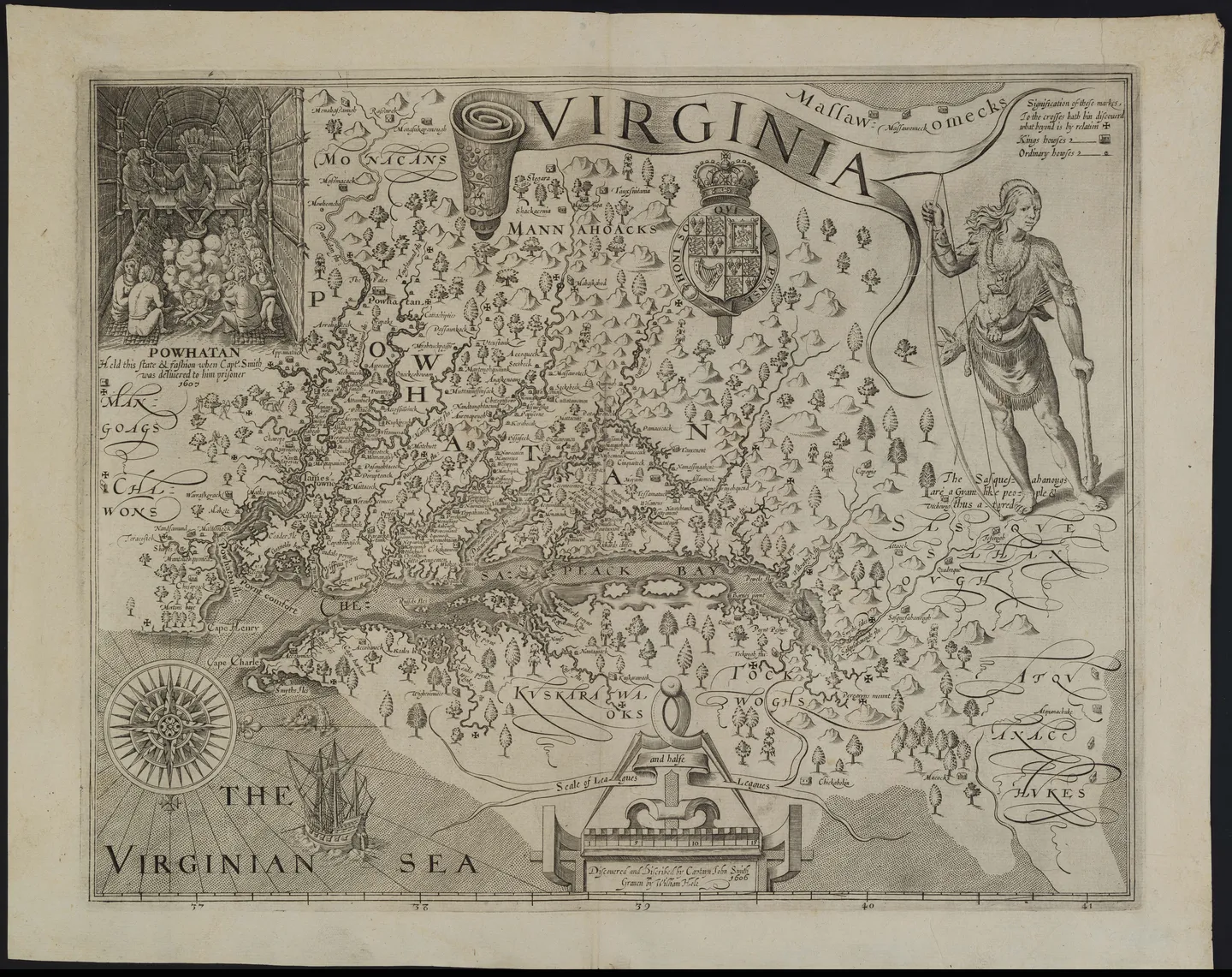
Captain John Smith created this map in 1612 after his explorations of about 3,000 miles of the Chesapeake Bay and related waterways in 1607 and 1608. During his open boat expedition with fourteen other European men, Smith asked the Indigenous tribes in the area about the surrounding geography, learning about the land and local tribes by just talking to them. His map shows the geography and locations of 166 villages from ten different tribes and served as the basis of British understanding of the area’s geography and people for over 50 years.
Creator:
John Smith (1580-1631), William Hole ( ca.1600-1646; engraver)
Date Created:
1612
Materials and Measurements:
Overall: 15 × 18 1/2in. (38.1 × 47cm) Framed: 22 1/2 × 26 5/8in Line engraving on laid paper